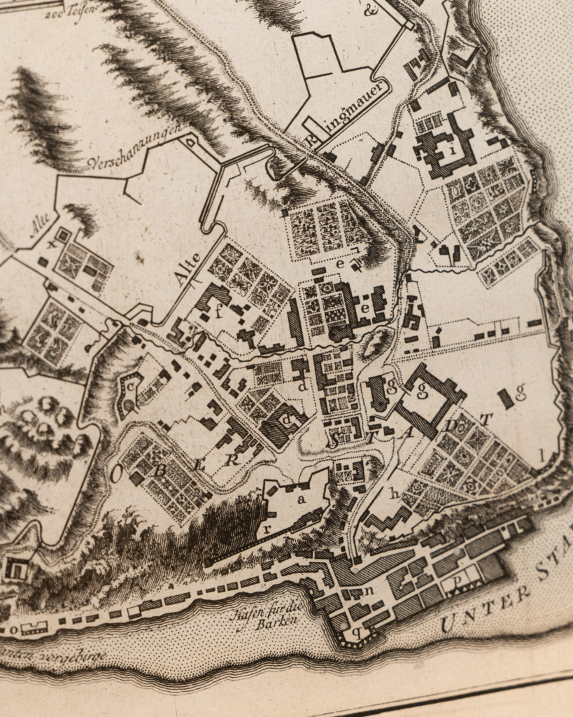
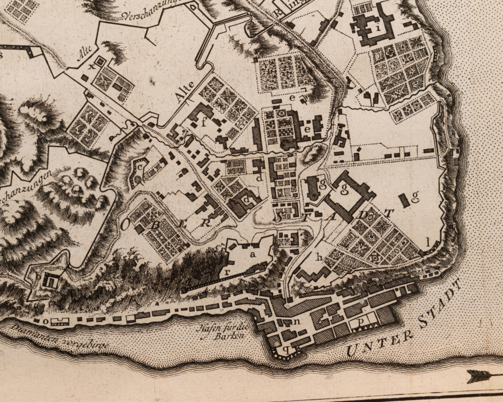
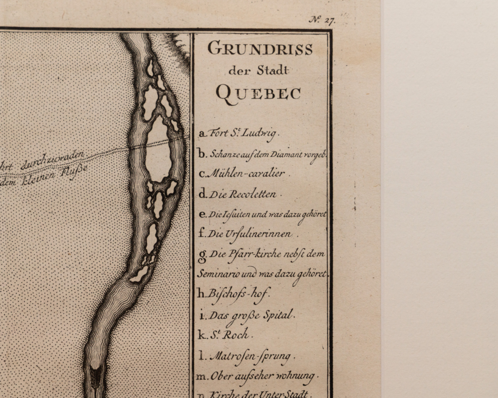
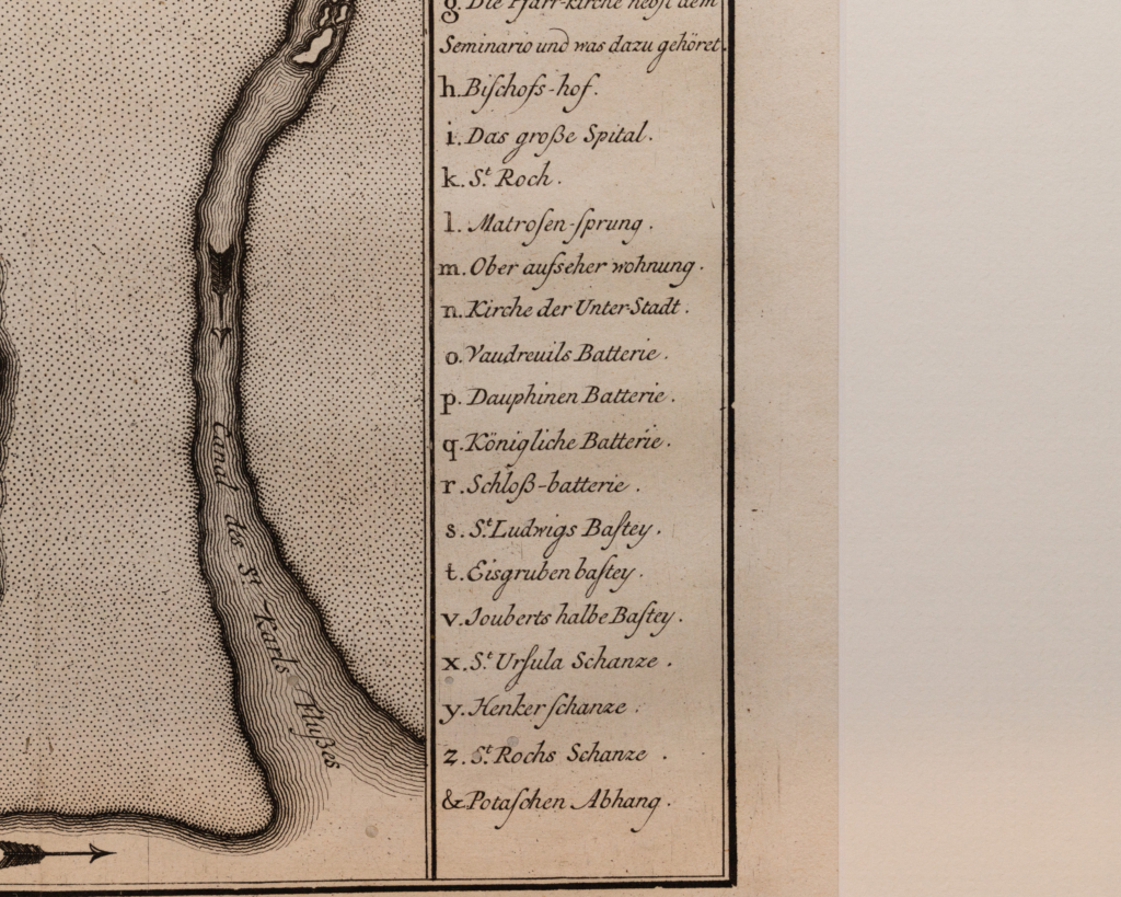
Engraving of Quebec by Jacques-Nicolas Bellin
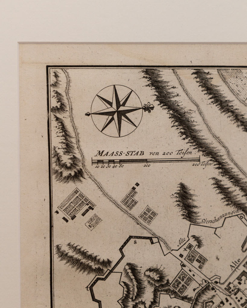
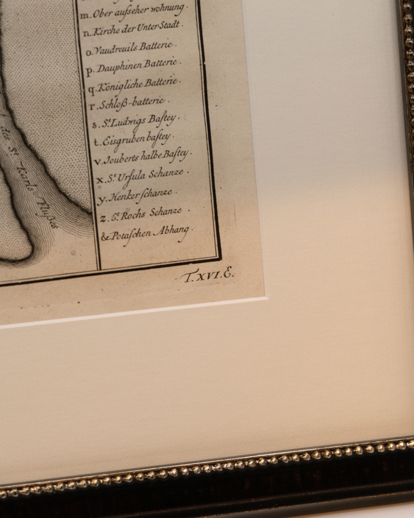
German version of the “Plan of Quebec” by Jacques-Nicolas Bellin printed in Paris in 1744.
The map is impressive and very detailed, focusing on the area around the Lower Town and showing many buildings, gardens, etc. The map includes a key on the right that identifies major buildings, etc.
This map appears in the Petit Atlas Maritime de Bellin, but it was first prepared for the History and General Description of New France by Charlevoix.
In 1720, the Duke of Orléans sent Jesuit scholar and explorer Pierre François-Xavier de Charlevoix to America to record events in New France and Louisiana and determine the best route to the Pacific Ocean. Charlevoix collected geographic information from fur traders in Quebec and traveled the Great Lakes and the Mississippi. After his return to France, Charlevoix published his views on North America in his Histoire et description général de la Nouvelle France, which became one of the most important works on North America during the period before the French and Indian War.
| Dimensions |
18 × 14 in |
| Year |
|